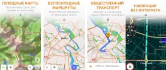
Genre : Navigation, Social Networks Developer/Publisher : Waze Inc. Version : 3.5.1 iPhone + iPad : Free [iTunes link]
There are a great variety of navigation programs for iPhone and other smartphones today. Many of them are offline and do not require an Internet connection, others, on the contrary, do need it. They are designed differently, they work differently, they are both 2D and 3D, and all at once. But the main goal of everyone is navigation . And all these applications are, first of all, terrain navigation tools. But there is a completely different program - Waze . When creating this application, a completely different principle was put at the forefront: Waze is, first and foremost, a social network . This phrase in this case is completely devoid of negative connotations.
This free application currently exists in iOS and Android versions. The maps are online, there is no way to download an entire city at once and use it without Internet access. Yes, it is not necessary, I will try to explain why in the text below.
Social network
When you first launch Waze, you are immediately prompted to create an account on a social network or connect with a Facebook account. At first I don't want to. And if you don’t want to, don’t, you can start working with the application with a temporary account, anonymously. But sooner or later the desire to register will appear, otherwise you will not be able to appreciate all the delights of the program. The essence of Waze comes down to some incomprehensible mixture of Foursquare, Facebook and Yandex.Maps. You move around the city using the application, give it destinations, and it, in turn, selects the optimal routes. As you move, statistics about your movement are collected and transmitted to the Waze servers, where information about traffic jams is updated and the most successful route for you is selected. The more users Waze has, the more accurate the traffic information is, and the more accurate the navigator works. It would seem that’s all, another clone of Yandex.Navigator. But no. There are glasses here! The more kilometers you travel with the application running, the more points your account receives. And you can get them for almost everything: information about traffic jams and their severity, messages about accidents, errors on the map, dangers on the road and beyond, warnings about difficult weather conditions, etc.
Drivers get excited. You are moving in a gray, dull city, once again running into a routine everyday traffic jam. Everyone around you is tormented in these already familiar torments of a senseless waste of time, and you play ! Everyone just stands there, and you raise your social status by doing such an important public service as informing others about traffic conditions. That's all! Karma improves, the mood rises, just like Grishkovets’s composition. You can argue with me, of course, because all this is in the same Yandex.Maps and Yandex.Navigator. Well, I do not! Nobody will pay you with points . If he doesn’t pay, it means the work, if not in vain, then at least goes unnoticed. And no one will like it or say thank you. And this “karma will not improve,” you know.
Saying “thank you” to yourself won’t work.
On April 20 of this year, I reviewed the updated navigator from Yandex, and this literally caused a flurry of messages in which I was strongly recommended to test the popular, and that’s exactly what they call it, Waze navigator. Enough time has passed, I have repeatedly tested this system and today I am ready to report to you.
Although the system is not new, Waze has gained widespread popularity quite recently. I'll start, as usual, with the interface. The first and main advantage is its simplicity. You can intuitively determine what you need at the moment. There is no clutter of icons, any incomprehensible icons or design designs, the result is concise and neat. There is no 3D mode, as well as no clear rendering of buildings. However, this is not the most important thing; what is more important is that the map itself can be enlarged with two fingers, and the orientation and direction can be changed.
Yes, once again about the menu, it is located at the very bottom of the screen, with its help you can leave comments, choose a route and even tell your friends about your location. As with most navigation systems, while navigating to your destination, you can easily cancel the route or view an alternative route. Among the disadvantages I would include the sloppily drawn cards; they are some kind of chopped, irregularly shaped, and look ugly. The advantages are simplicity and conciseness.
About voice typing: while in Yandex I can easily call an address in any form, I can’t do this in Waze. For example, I gave the address of Silver Rain. Waze gave me, in addition to the required Petrovsko-Razumovskaya Alley, Tikhomirova Street in Yubileyny, 75 kilometers of highway A 108, a gas station and one car wash. For what? I didn't order this. In general, there is a big gap here. Even cooperation with Google Maps did not help, although this bookmark is in the search menu and you can use Google maps rather than Waze maps. Maybe the whole point is that the company was created in the small state of Israel, where there is no such developed road infrastructure. I don’t know, I’ll just attribute this to shortcomings for now.
If we talk about the route itself and navigation, I liked that even in the absence of a stable Internet signal, Waze allowed me to pave the way. Yes, it won’t report traffic jams and road works, but it won’t go astray, that’s the main thing. The process of following the route itself is simple, no lanes, no voice warnings about cameras or road works. The problem here is that this is still a “people’s” navigator and all the information is provided by you and me, the users. Therefore, if we consider the system as a basic one, then it justifies its purpose. Everything will change, at least I hope, if there are more subscribers. In general, as an alternative navigation program, Waze fully justifies its purpose. Personally, when testing, I used both the new system and Yandex, it was easier to compare.
I hope that the system of points developed by the owners and various interesting applications for the program will increase its rating, as well as the number of subscribers. But it is still too early to talk seriously about competition. The fact that companies do not stop there, but try to constantly improve their product, is our merit. This is competition, healthy competition. And in it the struggle for the user comes to the fore. So let's evaluate, compare, scold and praise together.
Friendliness
That's not all. Waze is an incredibly kind app. When I first launched it, I involuntarily smiled and this pleasant feeling persisted throughout the entire time I used the program. Just look at the icon, it alone will make you feel moved. But in traffic jams, positive emotions are in short supply - fear is in short supply. This “good design” permeates the application through and through. You are driving along the route, you are late, you look at the road - a new section of the fourth transport has opened. You turn and rush. You look at the Waze map, and the program doesn’t even know about it. Some kind of gloating immediately awakens, you mock, you know, but they don’t. Once again you glance at Waze, and there is already this ball with wheels eating up the road. True, he eats like Pac-Man. And you get more points for drawing a new road on the map. And in a week, when you’ve driven along the road a dozen times and other users have taken rides, it will appear on the map, as if it had been here all your life. But you and I know who helped her appear.
The more reports submitted, the higher the “social status” in Waze. For editing the map and creating a new road, for example, points are also added
Sociality at its heart
The main idea behind Waze is to create an advanced platform for drivers to make it easier for them to move around the city. Therefore, a huge chunk of data in Waze depends on user activity; the fewer there are, the worse the map will be and the less route data there will be. Users can add information about traffic jams, traffic police posts, accidents, road hazards, cameras and road closures to the application. Among the useful additions, it is worth highlighting the ability to add the cost of gasoline to information about gas stations on the map.
User interaction with the app and each other is the cornerstone of Waze. While navigating with the app, other drivers can see you on the map and send you messages.
The program also has the opportunity to create communities and communicate on topics of interest.
The open Waze platform has the undeniable advantage that it allows motorists to create a map of their city, its points of interest (POI) and supplement it with current events on the road. Unfortunately, this approach also has a downside; the data can often be erroneous or simply irrelevant. Waze combats this with a ratings system; new users cannot make major changes to the map, and must first reach a certain number of points in order to advance to a higher level.
There are five of them in total. Users who have reached the fourth and fifth levels have the most opportunities to enter data. Points are gained through the use of Waze; the more kilometers a driver drives with navigation, the more points he has.
In Kyiv, and Ukraine in general, there are not very many Waze users, so the reliability of the data leaves much to be desired. In addition, the program takes information about traffic jams exclusively from the drivers themselves; as a result, if few people use the service, the data on traffic jams in it will be inaccurate.
Intelligence
After some time, you will definitely accumulate routes along which you move regularly. They can be saved. More precisely, the paths will be different each time, there will still be traffic jams, but the goal will be the same. One morning, when you start your car with the usual movement of your hand and launch Waze, you will be pleasantly surprised that the program itself will ask you if you would like to get directions, say, to work. Damn it, the devil is in the little things like this.
Waze will track your path constantly. If, when moving along the route laid out by the program, you constantly deviate, preferring some of your own special options, one fine day the navigator will understand you. Waze won't insist on turning left where you're used to going straight. And if you are stuck in a traffic jam, completely motionless, you won’t have to watch the boring and monotonous navigator screen. It will come to life, and pop-up banners will appear on the display, in which Waze will inform you about nearby traffic jams and traffic incidents nearby. Moreover, pauses become such informative even when stopping at a traffic light. Some people might find them annoying and can turn them off, but I find it incredibly convenient.
Pop-up window with information about traffic jams on the Third Transport Ring
And if it notices a slowdown in your movement along the route, Waze will definitely ask you what happened, if you are stuck in a traffic jam. And if you do get caught, you can quickly and easily inform other road users about the trouble that has arisen. Other drivers will say “thank you” and your virtual Waze points account will be replenished.
Traffic alerts are very easy to send at any time
Can I use Waze without the Internet?
The functionality of the Waze navigator involves active use of the Internet to synchronize data with other drivers and pedestrians, but it can also be used as an offline navigator. In the application - officially - it is impossible to save the necessary information to the smartphone’s memory, but users have found a way to do this. This method has a number of limitations, but nevertheless, it allows you to use the main functions of Waze without connecting to the network.
How to Save Waze Maps for Offline Use
To save data for later offline use, you must complete the following steps:
- Download the latest version of Waze here:
- To get started, you'll need a device connected to a Wi-Fi network that has Waze installed. This step is only relevant for new routes.
- Open the application and enter the address to which you want to build a path. Also, if necessary, you can specify the starting point (if it differs from the current location);
- When the route is created, launch the navigator as if you were planning to go to the specified point right now;
- The application will calculate the optimal route taking into account traffic jams and other road events, and then save it in the cache.
Now that the data has been recorded in the application's memory, you can use the saved route without an Internet connection.
The best offline navigators for Android
Cards
Waze's strength and weakness are its maps. On the one hand, all we need while driving is a route. That is, all kinds of 3D models of buildings, animated interchanges along the way, this is all unnecessary when you are on the move. All this slows down the display of the picture and, most importantly, the route. That's why Waze doesn't have it. The appearance of the maps is incredibly ascetic; except for roads and “green zones” of forest parks, there is practically nothing on them. Yeah, just like Apple.
On the other hand, there are almost no houses on Waze maps! It’s not clear whether they seemed unnecessary to the developers or whether they simply didn’t have time to draw everything, I think it’s more likely the latter. Nevertheless, navigation is quite accurate. The basic principle of this program is that the map consists of many segments formed by intersections and junctions. With some stretch, these segments can be called blocks, along which Waze navigates. The navigation program will take you to the desired area of the map. And the number of the house you are going to, alas, will have to be found on your own. Live, already on site.
Only the road. By the way, the chat can be either written or audio (with an attached audio recording, as in the picture)
The application has a fairly large database of POIs (points of interest), which are divided into categories of gas stations, parking lots, pharmacies, banks, shopping centers, cafes, restaurants, etc. Unlike houses, they exist on the diagram and are precisely defined.
The main advantage of the maps of this program is based on the basic principle of Waze: users help themselves and each other . Most of the inconsistencies and map errors are resolved very quickly by ourselves. This does not mean that the developers abandoned us to our fate. They didn't quit. Maps are regularly updated and drawn by Waze moderators. And due to their “online” nature, the changes made are displayed in the program instantly. But users also have the opportunity to be a cartographer. There is a special resource for this, which is best accessed from a computer. You pave a new road using a convenient service, save it, and a couple of days later (after checking by a moderator) you see these changes on your iPhone.
Nevertheless, no one is immune from comical mistakes. Periodically, when driving through the center of Moscow, the program makes sure that this section is the Moscow region.
Waze Maps
After purchasing the application, the maps of the same name received another source for displaying roads and routes laid by Waze users themselves. This ability to not only create your own route, but also edit maps in the social navigator is a distinctive feature of the Waze application, which is most useful when working online, although there is also a function for saving offline maps. You can literally draw your own map in Waze on top of a satellite map, indicating standard objects (roads, gas stations, parking lots).
The best offline navigators
To access the editing mode, you must log into your account on the Waze editor page, and also reach the second level of “development” in the application.
An interesting feature: Waze has a mapping hierarchy - users at a higher level can edit more objects and block some of them, refusing to make changes to less experienced wasers. The inconvenience of entering data in editing mode was also noted - for this it is optimal to use the desktop version of the editor, which is not always convenient. It has been noticed that the editor works most correctly in Google Chrome.
Driving on Waze maps is not complicated by displaying lanes, turns and other road signs, but it is possible to select a route based on the length of the path, road quality and other indicators.
Before starting to your destination or while driving, you can adjust your route and compare similar traffic patterns.
Since data about roads and situations on them is entered by users themselves, the display of information in Waze is not always correct - in densely populated areas you can quickly build the shortest route, successfully avoiding traffic jams or repair work areas, but in unpopular areas of a number of European countries, you can create a route and receive Data about the traffic situation may be difficult. In addition, the application is most effective when used online, so you will have to make sure you have access to the Internet. Sometimes there are difficulties in constructing routes over long distances (in case of insufficient drawing of roads).
Friends on the map
Finally, I would like to talk about the latest Waze update, 3.5. It came out of the blue and made a great app great. The fact is that the developers linked Facebook to the program and added the ability to organize meetings. That is, you introduce the program to all your friends who own modern smartphones based on Android OS or iOS, they log in with their Facebook accounts and you instantly become “friends” with them. And after that, you can share your location or travel destination with other Waze users.
Few friends yet
Using the program, you can organize a meeting, say, at an exhibition, invite friends to it and track their movements, knowing exactly when they will arrive (and where they stopped along the way).
Organizing a meeting is enabled in the main Waze menu
But even if a person refuses on principle to use Waze, no one obliges him. Access to your geolocation is easily enabled in the program and sent as a link to a web page via iMessage/SMS, email or Facebook. Anyone with active Internet access and a functioning browser will see you on the map until you turn off the display of your location. Yes, Apple has already come up with a similar app, Find My Friends, which I actively use, but Waze is like a Swiss pocketknife in your pocket. Everything is there, everything is well executed, everything works great. And the application functions not only in iOS, which will help Apple’s ideological opponents maintain friendship with you.
This is how an invitation is sent to track your location
Oh, yes, back in version 3.5 the icon was redrawn and it became even more “mi-mi-mi”.
How to add Facebook users to your friends list?
Waze, an open-source social navigation app, is integrated into the social networks Facebook and Twitter. So, you can add friends from these networks to Vaze's friends list.
To do this, go to the program settings from the main menu and select “Social networks” in the options menu.
Select the Facebook option in the menu and in the next form - “Connect”.
All that remains for us is to go through the authentication procedure by entering the username and password in the appropriate fields.
Navigation
Due to the fact that maps for Ukraine in Waze are incomplete, the application has problems with the quality of navigation. Although where the roads are marked normally, it builds quite adequate routes.
You can search on the map for both addresses and POIs (points of interest), these can be banks, gas stations, cafes, restaurants, attractions and other useful objects on the map. In this case, even though the Waze map is created by the users themselves, the application can pull up points with addresses from Google, as well as the Foursquare service. Therefore, there are no big problems with searching for objects in Waze. In general, you can navigate around the city with Waze, but you shouldn’t completely trust it; sometimes the program draws routes along non-existent roads.