Navitel Navigator
About, the maps of which are installed in almost every navigator, are known to all motorists. But Navitel also has its own navigator for iPhone, which works without the Internet.
The biggest problem with the app is its frankly outdated and poor interface. Holding a powerful modern smartphone in your hands and using a program with such an interface is the same as playing 8-bit games on a huge screen. But there are no complaints about functionality: the coverage area is such that you will feel at home in Europe, Asia and America. If you don’t pay attention to the interface, then Navitel is the best navigator without the Internet for iPhone.
Additional features include:
- search for organizations;
- display of traffic jam level;
- weather forecast;
- speed control;
- search for friends.
Navitel navigator can work offline, but consider the weight of the maps. If you set many countries, then the iPhone's memory will only go to them. Therefore, if you travel across the continent, you will periodically have to connect to free Wi-Fi in order to download a map of the next country. The main thing is that Navitel navigator for iPhone without the Internet works for free.
Updating Google Maps offline maps
If there are less than 15 days left until the card expires, the application will try to update. If a Wi-Fi connection is available, the update will be performed automatically.
In manual mode, maps can be updated in two ways:
- via notification;
- via the application.
Via notification
- Go to iPhone's main settings > Updates > next to Offline Maps, tap the Update icon.
- Click on the downloaded map that needs to be updated.
- Click "Update" and wait for the process to complete.
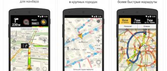
Yandex.Navigator
A powerful navigator for iPhone from Yandex, working without the Internet, which will help you get to a given point using the most convenient route. The application shows the path, and the auto-informer warns in advance about how to move and how long it will take to turn. The voice of the autoinformer can be changed - characters like Master Yoda or Optimus Prime are available.
Among the capabilities of Yandex.Navigator we note:
- speed control;
- display of traffic jams;
- notification about cameras on the road;
- “Conversations” mode, in which drivers share information about the situation on the road.
Yandex.Navigator can be used offline, but then some features will no longer work - for example, the same "Talk" mode. However, the main function works properly in any network condition, so if you want to download a navigator without the Internet on your iPhone, pay attention to the solution from Yandex.
About different navigators and the differences between them
You need to understand that every developer strives to make his application unique. Because of this, navigation apps may have different concepts. Some applications are designed exclusively for online use, while others can work without an Internet connection. The developers' approach to the user community is also different. On some maps, users can make changes on their own (add interesting places, etc.), while on others there is no such function and only blank maps are used. It is also worth noting that some applications are not strictly focused on navigation, but on other functions. For example, Waze is needed to control traffic jams, traffic control posts or security cameras. Drivers on the roads can notify each other about dangers and difficulties, so GPS navigation is rather a secondary function of this application.
The detail of the maps is influenced by who is its developer. First, it's worth mentioning proprietary and open source cards. Yandex and Google use their own maps for navigation. There are applications that use open analogues of maps (with a free license), for example - OsmAnd. In principle, all maps are more or less detailed, but there may be differences between them, and sometimes serious ones. It is also worth considering which country is key for the developer. In the case of Yandex, this is Russia, so maps of Europe on Yandex.Navigator will not be as detailed as maps of Russia.
Differences between car navigators
2 GIS
2GIS was one of the first applications in which maps are available without an Internet connection. The main advantage of this service is its information content. In 2GIS you can see where the organization is located, find out its operating hours and contact details. When building a route, the application takes into account how you will get to the desired point - on foot, by public transport, by car. For each method, the optimal option is selected.
To gain access to all information and mapping capabilities, you will still need the Internet when you first launch the application. So, connect to Wi-Fi before you go on your trip. For 2GIS to work, you need to download an offline map of the city. After downloading the map, you can safely disconnect from the network and not worry about getting lost in an unfamiliar area.
Offline maps for iPhone without Internet: review, list
2 GIS
2 GIS
One of the first applications where offline maps were implemented was 2 GIS. But these are not only mobile maps, but also a very convenient reference book. With its help you can find any establishment on the map in a couple of minutes. In addition to the address, information about opening hours and contacts is provided here.
The main feature of the application is that the map must be downloaded before you start using the application. The application does not work initially over the Internet, unless you simply download updates. For each case, the program is able to build one or more routes.
Yandex maps
Yandex maps
The offline function appeared not so long ago, but this does not mean that it is poorly implemented. Here you can also get a lot of important information. For example, when traveling by car, you can find out the condition of the road or the presence of traffic jams. In addition, she selects a convenient route to avoid traffic jams.
The route depends on how you want to get to your destination. At the same time, if you use a taxi, the price of the trip will be immediately displayed.
Yandex.Navigator
Yandex.Navigator
If Yandex.Maps is a universal program. Yandex.Navigator is made exclusively for motorists. It allows you to quickly get to the desired point along the most advantageous route. Just follow the prompts from the navigator. In order not to miss the required turn, auto-informing will tell you in advance where to go.
You can talk a lot about the capabilities of the application, but some of them especially stand out - speed control even according to specified parameters, notifications about cameras, traffic jams, work. You can even talk with other drivers in a special chat called “Conversations”.
Another nice addition is that the informant's voice can be changed. For example, you can listen to tips from Darth Vader, Master Yoda and other famous heroes. So be sure to try this navigator.
Navitel Navigator
Navitel Navigator
This is another convenient navigator for iPhone. If you have been driving a car for a long time and have used a navigator before, then you are definitely familiar with the manufacturer of these maps. If we consider specifically the application for iPhones, then little attention is paid to creating an interface, but the functionality is at the highest level.
For example, Navitel has the largest coverage. If you like to travel, you are unlikely to find a place where the navigator will not show you the way. Other features include the ability to view traffic jams, weather forecasts and speed control. In addition, here you can search and add friends.
Google Maps
Google Maps
For Google, Maps is considered one of the main services. If earlier the application was much inferior to Yandex in terms of functionality, now it has reached a decent level and has some options that its competitor does not have.
For example, places you have visited before are saved here. If you need your loved ones to always know your location, be sure to enable geodata transfer. If you don’t have access to the Internet, then just download the maps in advance and use them whenever it’s convenient for you.
MAPS.ME
MAPS.ME
A great app for those who love to travel. If you suddenly want to visit a previously unknown place, you can download a suitable map in advance and use it even without an Internet connection.
Among the main features, it stands out that you can choose places for entertainment, create a route, and there is also a search by establishments and they are all divided into categories. In addition, here you can save tags, send your location to friends and many other interesting functions.
All iPhone applications have very high quality maps. All roads and houses are clearly visible and you can always build a route to any desired place. At the same time, each of them has its own unique features, so that each user can easily choose the right option for themselves.
Yandex maps
Offline mode appeared in Yandex.Maps not so long ago, but quickly became popular among users who are not ready to remain constantly connected to the network. After downloading the map, you can build a route to any point, but all the functionality of the application is revealed when working online.
Yandex.Maps shows the current state of roads, suggesting ways to avoid traffic jams. The route is formed based on your method of travel: on foot, by car, by public transport. If you want to call a taxi, you can do it through Yandex.Maps, after looking at the cost of the trip.
Google Maps
To use Google Maps without the Internet, you must first download an offline map. The Google app offers the same features as Yandex.Maps, but it has one interesting feature - uploading photos of places you've visited. After a long journey, you will be able to trace the entire route using these photographs.
Another convenient feature is sending geodata to other users without using the Internet. For example, you can share your location via SMS.
MAPS.ME
Access to maps without the Internet is available after downloading the offline package. Among the main features of MAPS.ME are the selection of entertainment in the region, the formation of bicycle routes, the search for establishments by category, saving tags and quickly sending locations to friends.
MAPS.ME, like all the applications listed above, can be used as a navigator and a full-fledged reference book with verified information.
Published by Moftech
You may also be interested
Day One Diary: How to Write Without Paying Developers
How offline mode works in Google Maps
Before using offline maps, you will have to load the area or area of interest into your device's memory.
Depending on the area of the cached maps, the file size will change - up to 1.5 gigabytes. If your smartphone or tablet has a microSD card, you can move the saved zone to it. To do this, go to Application Settings → Offline Maps Settings → Storage → External Storage. It is important to remember that downloaded maps expire 15 days after the last update. The world is changing every day and Google doesn't want you to get lost due to outdated data or miss out on what is supposedly available to visit today.
To keep maps offline indefinitely, you need to enable automatic data updates in the application settings. As soon as you find yourself in the network access area, Maps will pull up the necessary updates and will be available again for 15 days without any warnings.
In offline mode, the application does not have some functions that the online version of the maps can offer. These include cycling and walking routes, traffic information and lane selection. Everything else works the same as usual, including 3D viewing and searching for all kinds of establishments and places.