Each point on the planet's surface has a specific position, which corresponds to its own latitude and longitude coordinates. It is located at the intersection of the spherical arcs of the meridian, which corresponds to longitude, with the parallel, which corresponds to latitude. It is denoted by a pair of angular quantities expressed in degrees, minutes, seconds, which has the definition of a coordinate system.
Latitude and longitude are the geographic aspect of a plane or sphere translated into topographic images. To more accurately locate a point, its altitude above sea level is also taken into account, which makes it possible to find it in three-dimensional space.
Latitude and longitude
The need to find a point using latitude and longitude coordinates arises due to the duty and occupation of rescuers, geologists, military personnel, sailors, archaeologists, pilots and drivers, but it may also be necessary for tourists, travelers, seekers, and researchers.
What is latitude and how to find it
Latitude is the distance from an object to the equator line. Measured in angular units (such as degrees, degrees, minutes, seconds, etc.). Latitude on a map or globe is indicated by horizontal parallels - lines that describe a circle parallel to the equator and converge in the form of a series of tapering rings towards the poles.
Lines of latitude
Therefore, they distinguish between northern latitude - this is the entire part of the earth’s surface north of the equator, and also southern latitude - this is the entire part of the planet’s surface south of the equator. The equator is the zero, longest parallel.
- Parallels from the equator line to the north pole are considered to be a positive value from 0° to 90°, where 0° is the equator itself, and 90° is the top of the north pole. They are counted as northern latitude (N).
- Parallels extending from the equator towards the south pole are indicated by a negative value from 0° to -90°, where -90° is the location of the south pole. They are counted as southern latitude (S).
- On the globe, parallels are depicted as circles encircling the ball, which become smaller as they approach the poles.
- All points on the same parallel will be designated by the same latitude, but different longitudes. On maps, based on their scale, parallels have the form of horizontal, curved stripes - the smaller the scale, the straighter the parallel strip is depicted, and the larger it is, the more curved it is.
Remember! The closer to the equator a given area is located, the smaller its latitude will be.
How to find out on your phone
An equally important question is how to view the coordinates of a place in Google Maps if you only use the application on your smartphone. In this case, the algorithm of actions is even simpler:
- Log into Google Play and download the Google Maps app if you haven't already.
- Log in to the program.
- By moving the area with your finger, zooming in and out of the picture, find the desired point.
- Press and hold it. Pay attention to the inscription that appears below.
- To find out the coordinates of a place in Google maps, click on the name of the highlighted place.
- In the window that appears, find your location data.
- Click on the coordinates. The system reports that the numbers have been copied to the clipboard.
- Paste them into a document or transfer them to another user using any of the available methods.
In this way, you can obtain data about any other point on the map, be it a populated area or another area.
What is longitude and how to find it
Longitude is the amount by which the position of a given area is removed relative to Greenwich, that is, the prime meridian.
Lines of longitude
Longitude is similarly characterized by measurement in angular units, only from 0° to 180° and with a prefix - eastern or western.
- The Greenwich Prime Meridian vertically encircles the globe of the Earth, passing through both poles, dividing it into the western and eastern hemispheres.
- Each of the parts located west of Greenwich (in the Western Hemisphere) will be designated west longitude (w.l.).
- Each of the parts distant from Greenwich to the east and located in the eastern hemisphere will bear the designation east longitude (E.L.).
- Finding each point along one meridian has the same longitude, but different latitude.
- Meridians are drawn on maps in the form of vertical stripes curved in the shape of an arc. The smaller the map scale, the straighter the meridian strip will be.
Remember! The further the desired point moves away from Greenwich, the greater its longitude will be; the closer it is, the shorter its longitude will be.
How to find the coordinates of a given point on the map
Often you have to find out the coordinates of a point that is located on the map in a square between the two nearest parallels and meridians. Approximate data can be obtained by eye by sequentially estimating the step in degrees between the mapped lines in the area of interest, and then comparing the distance from them to the desired area. For accurate calculations you will need a pencil with a ruler, or a compass.
- For the initial data we take the designations of the parallels closest to our point with the meridian.
- Next, we look at the step between their stripes in degrees.
- Then we look at the size of their step on the map in cm.
- We measure with a ruler in cm the distance from a given point to the nearest parallel, as well as the distance between this line and the neighboring one, convert it to degrees and take into account the difference - subtracting from the larger one, or adding to the smaller one.
- This gives us the latitude.
Example! The distance between the parallels 40° and 50°, among which our area is located, is 2 cm or 20 mm, and the step between them is 10°. Accordingly, 1° is equal to 2 mm. Our point is 0.5 cm or 5 mm away from the fortieth parallel. We find the degrees to our area 5/2 = 2.5°, which must be added to the value of the nearest parallel: 40° + 2.5° = 42.5° - this is our northern latitude of the given point. In the southern hemisphere, the calculations are similar, but the result has a negative sign.
We find longitude in the same way - if the nearest meridian is further from Greenwich, and the given point is closer, then we subtract the difference, if the meridian is closer to Greenwich, and the point is further, then we add it.
If you only have a compass at hand, then each of the segments is fixed with its tips, and the spread is transferred to the scale.
In a similar way, calculations of coordinates on the surface of the globe are carried out.
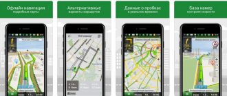
How to get coordinates in Google Maps app
You can also get GPS coordinates from the Google Maps mobile app on your mobile device. It works on both Android and iPhone, but the steps are slightly different for each.
If you 're using Android , you'll see the coordinates at the very top of the screen.
- Open the Google Maps app and select and hold a location until you see a red pin.
- Look in the search box at the top of the screen to find the coordinates.
If you 're using an iPhone , you'll find the coordinates at the bottom of the screen when you open location information.
- With the Google Maps app open, select and hold the point on the map where you want to place the red pin.
- Select the top of the information map at the bottom of the screen to display location details, including coordinates.
- Select and hold coordinates to copy them.
The best services for finding a place by coordinates
The easiest way to find out your location is by logging into the PC version of the service, which works directly with Google Maps. Many utilities make it easy to enter latitude and longitude in a browser. Let's look at the best of them.
Map & Directions
On the official Maps & Directions website you can find the exact GPS coordinates of any point, or select the desired location and see its width and longitude. The service is very easy to use, it includes an option to zoom in on the map and the ability to share your location.
In addition, Maps & Directions allows you to determine the coordinates of your position on the map for free by clicking just one button. Click on “Find my coordinates”, and the service will immediately place a marker and determine the latitude, longitude to many thousandths, as well as altitude.
On the same site you can measure the distance between settlements or the area of any given territory, draw a route or calculate travel time. The service will be useful for both travelers and simply curious users.
Mapcoordinates.net
A useful utility, Mapcoordinates.net, allows you to find out the coordinates of a point in any region of the world. The service is also integrated with Google Maps, but has a simplified interface, thanks to which even an untrained user can use it.
In the address bar of the utility, where it says “Search,” enter the address of the place, latitude and longitude of which you want to get. A map with coordinates will appear along with a marker at the desired location. The latitude, longitude, and altitude of the selected point will be displayed above the marker.
Unfortunately, Mapcoordinates.net is not suitable for searching for points knowing their coordinates. However, for the reverse procedure, this is a very convenient utility. The service supports many languages, including Russian.
Device functionality
The operation of GPS navigation is based on assessing the position of an object taking into account satellite readings.
The mobile device has a module for such tracking - a GPS sensor. Its location on Earth is determined by satellites. Using a similar principle, you can determine the coordinates of any city, car and person using the GLONASS system.
If you turn off the sensor, the signal will not be transmitted to the satellite . In this case, it is impossible to find the device. This happens when a user turns off geolocation to save battery power. If the device is working, the signal is sent to the mobile phone.
Satellite data is used to determine a location using latitude and longitude coordinates. The result is displayed in degrees and minutes. Any point is characterized by certain coordinates. Many globe services work on this principle (Google, Mail, Yandex). The exact algorithm of actions depends on the application used.
Of the entire Internet network, the following services are considered the most accurate:
- Yandex.
- Google.
Search by coordinates on the map through a browser using the Google Maps service
If for some reason you prefer to work not with simplified services, but directly with Google Maps, then these instructions will be useful for you. The process of searching by coordinates through Google Maps is a little more complicated than in the methods described earlier, but it can be mastered quickly and without much difficulty.
To find out the exact coordinates of a place, follow these simple instructions:
- Open the service on your PC. It is important that the full mode must be turned on, and not the light mode (marked with a special lightning icon), otherwise it will not be possible to obtain information;
- Click on the section of the map where the item or point you need is located, with the right mouse button;
- Select the “What’s here?” option in the menu that appears;
- Look at the tab that appears at the bottom of the screen. It will display latitude, longitude and altitude.
To determine a location using known geographic coordinates, a different procedure will be required:
- Open Google Maps in full mode on your computer;
- In the search bar at the top of the screen you can enter coordinates. This can be done in the following formats: degrees, minutes and seconds; degrees and decimal minutes; decimal degrees;
- Press the “Enter” key, and a special marker will appear on the map at the required location.
The most important thing when using the Google Maps service is to correctly indicate geographic coordinates. Cards only recognize a few data formats, so be sure to keep the following input rules in mind:
- When entering degrees, use the special character to indicate it as "°" rather than "d";
- You must use a dot rather than a comma as a separator between the integer and fractional parts, otherwise the search string will not be able to return the location;
- Latitude is indicated first, then longitude. The first parameter must be written in the range from -90 to 90, the second - from -180 to 180.
Finding a special character on a PC keyboard is difficult, and in order to adhere to the required list of rules, you need to put in a lot of effort. It is much easier to use special utilities - we have listed the best of them in the section above.
Working with Internet globes
To navigate on Yandex Map by coordinates, it is recommended to download the service to your mobile device. When you click on the link, a search engine appears at the top left of the page. The coordinates are entered into the line. If you press the Enter button, you can define the area on the map.
If your Internet connection is poor, the app may load slowly. In this case, it is recommended to use third-party online services. Their work is based on searching for points by longitude and latitude. In fact, they operate on the basis of the same Google or Yandex. The difference between services and GPS navigation is the absence of additional functions and the presence of a more convenient system for entering coordinates.
Advantages of ready-made online services:
- user-friendly interface;
- quick location determination (the site loads faster than the world map itself).
The disadvantages of the services are associated with the involvement of additional secondary Internet resources.
The site kakdobratsyado.ru is considered the most accurate. It runs on the Yandex engine. The downside is that it takes a long time to load.
To find out the location you will need:
- Enter the coordinates (width, longitude, height) in the appropriate box.
- In the “Scale” column, the data changes automatically. It depends on how many percent the image on the screen of a mobile device or computer is moving closer/farther away.
- The “Enter” button is pressed.
If you need to build a route or find an address without the Internet, the user can use the automatic launch of Yandex . If while moving or viewing already downloaded data the mobile network signal disappears, Yandex. maps will continue to guide the user along the route.
To use the offline mode, maps are downloaded in advance. To keep them up to date, it is recommended to enable automatic updates. When the connection to the global network is restored, the application checks for a faster route and its existence.
Google Maps
When working with Google maps, you can find the location or determine the coordinates of known points. If a settlement is not on the map, you can add it using the special “+ code” button. Stages of entering terrain coordinates:
- Google maps opens on PC.
- The corresponding coordinates are entered in the search engine window.
- A marker appears on the screen.
To find out the data, open the corresponding application (with the simplified mode turned on, it is impossible to find out the coordinates). Click on the corresponding section of the map. Select the appropriate item. Latitude and longitude appear on the screen below. To send your location on a Google map, you will need to click on the “Submit” button.
You can share data using the card information window. This method creates an email with a link to the location.
To obtain data in 3 formats, the Traveleu service is used. It is powered by Google Maps.
To find out the location, it is recommended to follow a certain algorithm:
- Entering the desired coordinates into the search bar.
- Pressing the "Enter" button.
- After refreshing the page, the point appears on the map.
Due to periodic system errors, the service may not work.